Spotlight: Migrants on both sides of the Atlantic
by Deborah Buehler originally published in Wader Study 129(2)
Migrant birds move to get what they need.
Shorebird migration to exploit seasonally fluctuating resources has been studied for years and researchers have mapped globe-spanning networks of places where birds reproduce at breeding areas, refuel at stopover sites, and spend the non-breeding season at wintering areas. Still, new sites of importance continue to be found and growing datasets compiling bird sightings over decades are integral to this work. Even within a site, migrants move to exploit resources, and much remains to be discovered at these smaller geographic and shorter-time scales.
In this issue of Wader Study, two papers examine migrant movements on opposite sides of the Atlantic and at different scales. Both highlight the overlooked significance of relatively small sites for the health of shorebirds along a larger flyway. Mary Pelton, Sara Padula and colleagues document the importance of the Kiawah and Seabrook islands in South Carolina, USA using surveys and modelling to provide population estimates for Red Knots, Calidris canutus rufa.1 Clément Jourdan and colleagues use GPS telemetry to analyse the movements and behaviour of wintering Black-tailed Godwits Limosa limosa islandica in France and describe the birds’ use of wetlands over different temporal scales.2
In South Carolina, the researchers focused on a subspecies of Red Knot. Rufa knots are listed as threatened in both Canada and the United States due to an 85% population decline over the past few decades. The researchers’ goal was to estimate the number of rufa knots using a 24-km stretch of sandy beach in the Kiawah-Seabrook Island complex (hereafter KSI) and to further understand where they came from, where they were going, and whether some birds used the site throughout the non-breeding season.
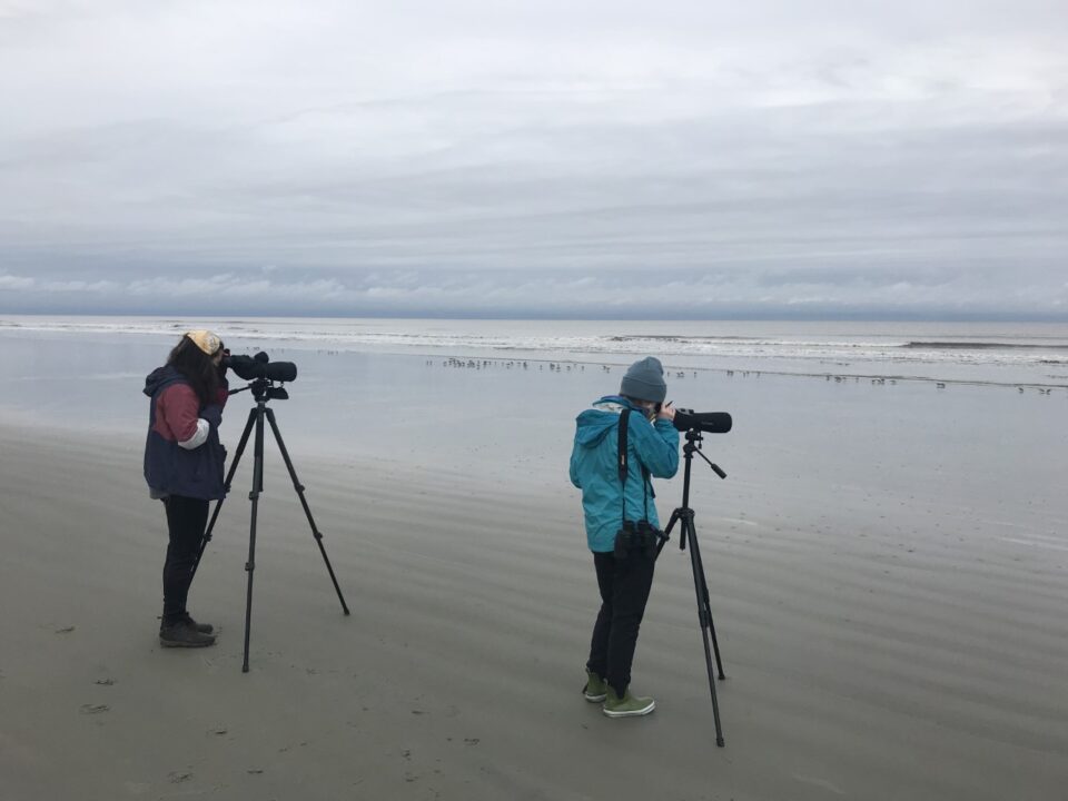
Scanning for colour-marked birds during surveys (photo: Mary Margaret Pelton)
To do this, they conducted on-the-ground surveys between 19 February and 20 May 2021. Prior to this, they also deployed geolocators on birds captured at the site between April 2015 and May 2016. Geolocators periodically record ambient light level (solar irradiance) to determine location; however, the bird needs to be recaptured to download the data. Although a total of 33 geolocators were deployed, only three were retrieved as part of this study.
When shorebirds are captured in North and South America, they are marked with flags consisting of a unique alphanumeric code. Marking follows the Pan American Shorebird Group protocol,3 and flags are colour coded to the area the bird was first marked; for example, Canada (white), the United States (green), Argentina (orange). When the bird is seen again, researchers know at a glance where the bird was first marked and can identify the individual by the code. In their surveys, the researchers in South Carolina recorded the presence of birds that had been previously marked, and they sometimes saw the same birds multiple times over the season. This is called resighting. They also estimated the ratio of marked to unmarked birds. This information allowed them to use statistical models to estimate the number of birds passing through the area (passage population) and how long they stayed (stopover duration).
KSI lies south of Delaware Bay, which has historically been regarded as the last steppingstone for birds migrating from further south to refuel before departing for their Arctic breeding grounds. However, mounting evidence in the past decade shows that birds likely use a suite of stopover sites, not Delaware Bay alone. Because shorebird marking has been standardized in the Americas since the mid-1980s, the researchers had access to an online database, www.bandedbirds.org, containing decades of data. Using this resource, they analysed previous capture and resighting data for all of the 217 uniquely flagged birds they resighted during their 13-week study. This work revealed that the birds had accessed a network of more than 70 sites spanning Texas to Florida to Massachusetts in the USA, as well as Ontario (James Bay) and Quebec in Canada. Results from the three geolocator-carrying birds also indicated that Delaware Bay was not be the only place to rest before leaving for the Arctic. All three birds skipped Delaware Bay after stopping in South Carolina.
The researchers also found evidence that rufa knots might be using KSI for overwintering as well as stopover. First, their surveys indicated an estimated ~2,400 birds present at KSI as early as 19 Feb, and many were subsequently observed again in May, suggesting that they had stayed throughout the winter. Second, as the season progressed the number of birds increased, indicating an influx of new birds from further south. Thus, KSI likely supports two groups of rufa knots: those that spend the non-breeding season there, and those that migrate through, using the site as a stopover. The idea that distinct groups might exist within the rufa subspecies is not new. Major nonbreeding clusters of rufa knots have been found in the south-eastern USA (Florida and Texas), north-central Brazil, and Tierra del Fuego. Genetic work by Yvonne Verkuil and colleagues described evidence that suggests that these groups might also be genetically different.4
Importantly, the statistical modelling indicated a minimum of 17,000 rufa Red Knots (over 40% of the total population) used KSI during their study period. Combined with other findings, this provides ample evidence that KSI is important along the flyway as a stopover and overwintering site for rufa Red Knots. The site is also important for other shorebird species. Another recent study reported a nocturnal roost supporting nearly half of the Atlantic Flyway population of Hudsonian Whimbrel Numenius hudsonicus on Deveaux Bank, right next to KSI.5 The authors recommend the nomination of KSI and neighbouring Deveaux Bank as a Site of Hemispheric Importance in the Western Hemisphere Shorebird Reserve Network.
On the other side of the Atlantic, in France, Clément Jourdan and colleagues were focused on another long-distance migrant, the Black-tailed Godwit. Unlike rufa knots, the population of the islandica godwit subspecies has been increasing for several decades. They are omnivorous and able to exploit multiple habitats, making them ideal for studying habitat choice in wintering sites over different temporal scales. The researchers worked on the French Atlantic coast focusing on wintering habitats within a 6,000 km2 area including the Loire Estuary, Bourgneuf Bay, the Vendée Coast, and the Pertuis Charentais area, where most of France’s Black-tailed Godwits spend the non-breeding season.
The goal was to describe how birds used the space at a single wintering site by identifying the most-used habitat for each individual on each monitoring day, then investigating when birds changed their daily most-used habitat over the season. The researchers also studied habitat choice across the span of a single day (within days) to describe habitat shifts over 24-hour periods. They used an existing system to classify the habitat types and focused on ‘cropping systems’ (i.e., arable land), ‘inland marshes’, ‘coastal marshes’, ‘saltpans’, ‘bare mudflats’ and ‘other habitats’ (i.e., land not normally used by godwits) for this study.
The researchers used GPS telemetry to track the birds’ movements. To install the GPS tags, birds were captured at night with mist nets set on their high tide roosts between November 2016 and October 2018. All birds were weighed, measured, and their age and sex were determined. They were then marked with a metal ring and a unique colour ring combination. GPS tags were fitted to the heaviest individuals only, so as not to exceed 3% of the bird’s body mass. The GPS tags recorded location every thirty minutes or so and with an accuracy of plus or minus ten meters. The researchers only used data from godwits with at least one month of wintering data on the Central French Atlantic coast for this study. Ten birds fit these criteria and were monitored from 3 March 2016 to 24 April 2020.
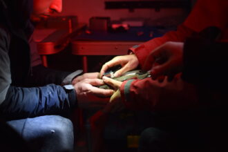
Deploying a GPS tag (photo: Thierry Guyot)
At the level of habitat choice over a season, Jourdan and colleagues found that most islandica godwits used intertidal areas from early to mid-winter, then moved to inland marshes just before the spring migration period. This finding supports previous work which has shown this shift, with authors suggesting that it occurs in response to seasonal prey depletion on intertidal habitats. The birds move inland to habitats to follow the abundance of food.
At the level of habitat shifts within a day, habitat use in coastal areas depended on the tide. Birds fed in intertidal habitats like ‘bare mudflats’ at low tide and used the coastal marshes to rest (roost) at high tide regardless of time of day. When using inland habitats, like ‘inland marshes’, they were often observed roosting during the day, with feeding activity occurring mainly at night. One interesting observation was the birds’ use of hunting ponds. Hunters attract ducks to these ponds and hunt them at night between early August and late January. During the hunting season, the researchers found that shorebirds mainly exploited these ponds during the day, but after the hunt closed, the birds used the ‘hunting ponds’ both day and night.
Migrant birds move around – a lot – and they do this at varying space and time scales. Pelton, Padula and colleagues explored this at the level of a chain of stopover and wintering sites on the Atlantic coast of the United States. On the other side of the ocean, Jourdan and colleagues looked at how birds shift between different habitat types within a wintering area. Half a world away in India, researchers are starting to gather data for what will hopefully be another long standing dataset of captures and resightings.6 These studies show that there is much yet to discover about migrant shorebirds in terms of where they go, when they go and why those places they stop at are important.
1 Pelton, M.M., S. R. Padula, J. Garcia-Walther, M. Andrews, R. Mercer, R. Porter, F. Sanders, J. Thibault, N. R. Senner & J. A. Linscott. 2022. Kiawah and Seabrook islands are a critical site for the rufa Red Knot (Calidris canutus rufa). Wader Study 129: 105–118.
2 Jourdan, C., J. Fort, F. Robin, D. Pinaud, P. Delaporte, D. Desmots, A. Gentric, P. Lagrange, J. Gernigon, L. Jomat, P. Rousseau & P. Bocher. 2022. Combination of marine and freshwater artificial habitats provide wintering Black-tailed Godwits with landscape supplementation. Wader Study 129: 86–99.
3 Pan American Shorebird Group. 2016. Pan American Shorebird Program Shorebird Marking Protocol. https://www.shorebirdplan.org/wp-content/uploads/2016/08/PASP-Marking-Protocol-April-2016.pdf
4 Verkuil, Y.I., E. Tavares, P.M. González, K. Choffe, O. Haddrath, M. Peck, L.J. Niles, A.J. Baker, T. Piersma & J.R. Conklin. 2021. Genetic structure in the nonbreeding range of rufa Red Knots suggests distinct Arctic breeding populations. Ornithological Applications 124: duab053.
5 Sanders, F.J., M.C. Handmaker, A.S. Johnson & N.R. Senner. 2021. Nocturnal roost on South Carolina coast supports nearly half of Atlantic coast population of Hudsonian Whimbrel Numenius hudsonicus during northward migration. Wader Study 128(2): 117–124.
6 Panigrahi, M., P. Sathiyaselvam & T. Katti. 2022. Additions to ring resightings and recoveries of migratory shorebirds at Marine National Park and Sanctuary, Gujarat, India. Wader Study 129: 148–150.
PDF of this article
Featured image: Black-tailed Godwit, March 2020 France, (c)Fabrice Cahez.